
Why a Quality Boundary Survey Matters for Property Owners
If you own property—or plan to buy, sell, or develop it—it’s important to know exactly where your land begins and ends. That’s where a boundary survey comes in.
You may have seen mortgage inspections or GIS (Geographic Information System) maps, but while these tools offer general guidance, they don’t provide the legal clarity or accuracy that comes from a survey performed by a licensed land surveyor. Here’s why a proper boundary survey is a smart investment for homeowners.


What Is a Boundary Survey?
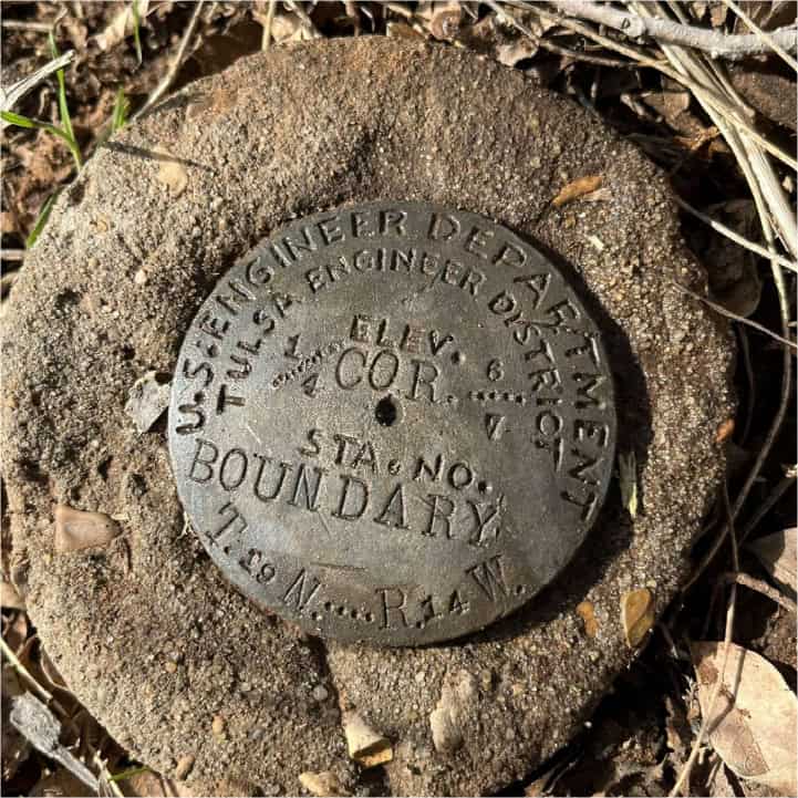
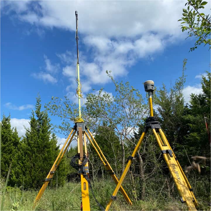
A boundary survey is a professional process used to determine the exact lines and corners of your property. It involves taking measurements on the ground, reviewing past records and deeds, and often placing physical markers to show where your boundaries are.
It’s especially important when you’re:
- Buying or Selling a home
- Building a fence or addition
- Dividing a lot
Why Legal Clarity Matters
One of the biggest benefits of a boundary survey is legal certainty. Mortgage inspections, for example, are completed for loan purposes. They don’t define your legal boundaries, identify potential issues, and they shouldn’t be relied upon to settle disputes.
A boundary survey, on the other hand, provides a clear, court-recognized definition of your land. That means if there are questions about fence lines—or if there’s any confusion about property limits—you have reliable documentation to rely on.
This is especially helpful in older neighborhoods or rural areas where past records might be unclear or inconsistent.


Why Not Just Use My Mortgage Inspection Report (Certificate)
Mortgage inspections and GIS maps are not boundary surveys.
-According to the Oklahoma Minimum Standards for the practice of land surveying, mortgage inspection reports (certificates) are “not a land or boundary survey plat, and it is not to relied upon for the establishment of fence, building, or other future improvement lines." Mortgage inspection reports are valuable in many ways, but should never be utilized in place of a boundary survey completed by a licensed land surveyor.
- GIS maps are helpful for general planning but aren’t intended to provide an assessment of the existing conditions related to a boundary survey.
Only a boundary survey gives you the precise, on-the-ground measurements and field evidence needed to accurately define your property.
A Boundary Survey Can...
Help You Plan and Build with Confidence
Thinking about building a fence, garage, or home addition? A boundary survey shows your parcel limits and potential “building-limits”, if any exist.
This helps you:
- Avoid costly mistakes like building over boundary lines
- Identify building limits that could affect your project
- Stay compliant with city or county regulations
An investment in a survey can save money and project delays down the road.
Boost Property Value and Speeds Up Sales
If you're selling, a recent boundary survey can make your listing more attractive. Buyers feel more confident when they know exactly what they’re getting, and that clarity can help speed up closing.
Mortgage inspections and GIS maps are valuable tools—but they’re not meant to define legal boundaries.
Only a boundary survey completed by a licensed land surveyor:
- Supports confident construction and development
- Helps prevent and resolve disputes
- Adds peace of mind for buyers and sellers
Ready to protect your property and plan with confidence?
Contact our team today to schedule your boundary survey.
